About Ultrabeam
Ultrabeam Limited, trading as Ultrabeam Hydrographic, was founded in early 2018 by Gabriel Walton and Andy McLeay—industry veterans with over 55 years of combined experience in coastal and offshore survey operations. The company was established to deliver high-quality hydrographic and geophysical survey services to a wide client base across ports and harbours, utilities, offshore renewables, oil and gas, and the public sector.
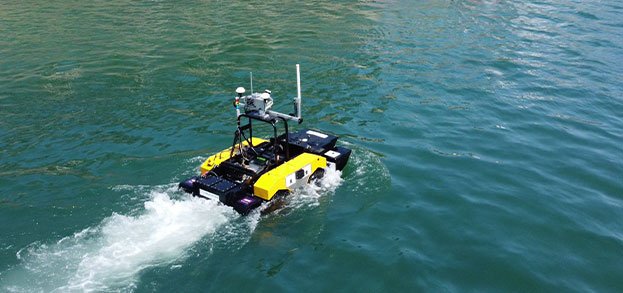
From the outset, Ultrabeam has redefined marine asset inspection by pioneering the use of in-house designed and built uncrewed surface vessels (USVs). This approach enhances safety, efficiency, and data precision—particularly in hazardous or hard-to-access environments—compared to traditional survey methods.
Our USV-led surveys are integrated with cutting-edge data processing and advanced 3D visualisation platforms, producing deliverables that consistently exceed industry standards. Ultrabeam’s strength lies in our data quality, powered by specialist survey tools and techniques, and supported by extensive experience in both shallow and deep-water environments.
Unlike companies where hydrography is a secondary service, Ultrabeam is singularly focused on high-precision marine survey and inspection. Our approach is grounded in continual research and development, alongside strategic investment in commercially available, best-in-class technologies.


Andrew McLeay
Managing Director

Gabriel Walton
Technical Director

Simon Baldwin
Project Manager

Matt Shenton
CAD/GIS Project Manager

Rob White
Senior Geophysicist

Toby McLeay
Survey Technician

Ross Sheppard
Senior Hydrographic Surveyor

Joleen Skinner
Ecologist

Nick Brickland
Electrical Engineer
View our services